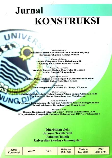
KONSEP KONSTRUKSI INTEGRASI UNSUR-UNSUR PEMANFAATAN LAUT WILAYAH DALAM PERSPEKTIF KADASTER KELAUTAN DAN UU NO.l TAHUN 2014
DOI:
https://doi.org/10.33603/jki.v4i4.2260Abstract
Abstrak
Indonesia sebagai negara kepulauan mcmiliki wilayah laut yang lebih luas dari wilayah darat, 13.466 pulau (Badan Informasi Geospasial, 2013) dengan garis pantai sepanjang 99.093 km (Badan Informasi Geospasial. 2013) menjadikan Indonesia memiliki sumber daya alam laut yang lebih banyak dibandingkan dengan sumber daya alam di darat. Kondisi potensi sumber daya laut ini dipandang sebagai peluang Indonesia sebagai negara berkembang untuk membangun keunggulan dibidang pesisir dan kelautan. Namun selama 69 tahun bangsa ini merdeka, sektor kelautan teniyata belum dapat menunjukkan sebagai sektor yang dapat diunggulkan oleh bangsa dan diandalkan oleh rakyat Indonesia.
Bcrdasarkan studi pustaka, temyata masalah utama yang terjadi di laut Indonesia salah satunya adalah belum adanya keterpaduan kegiatan pemanfaatan ruang laut sccara sektoral, daerah (provinsi dan kabupaten/kota) maupun adat. kondisi ini seringkali menyebabkan tumpang tindih klaim {overlapping claim) wilayah laut yang dapat memicu konflik sengketa batas wilayah laut antar daerah, sektor maupun adat.
Tulisan ini membahas mengenai konsep konstruksi integrasi unsur-unsur pemanfaatan laut wilayah Indonesia. Konsep integrasi unsur-unsur pemanfaatan laut dapat dibangun menggunakan unsur-unsur kadaster (right, restriction, responsibility), asas keterpaduan dan kepastian hukum yang tercantum di dalam UU No. 1 Tahun 2014 tentang Pengelolaan Wilayah Pesisir dan Pulau-pulau Kecil.
Â
Kata kunei: right, restriction, responsibility, asas keterpaduan, asas kepastian hukum, asas peran serta masyarakat, asas disentralisasi.
Â
Abstract
Indonesia as an archipelagic country’ has marine area larger than land area, 13.466 islands (Geospatial Information Agency, 2013) with coastline 99.093km (Geospatial Information Agency, 2013), making Indonesia has natural resources of the sea more than the natural resources on land. This potential conditions of marine resources is seen as an opportunity for Indonesia as a developing country to build excellence in coastal and marine field. But during 69 years of the nation's independence, maritime sector has not proved as a sector that can be seeded by the nation and relied by Indonesian people. Based on the literature, one of the main problems in Indonesian ocean is marine boundaries determination are unclear and unresolved causes uncontrolled human intervention in managing marine resources and chaotic patterns of use of marine resources, uncontrolled utilization even destructive.
Based on the literature, one of the main problems in Indonesian ocean is unintegration of utilization activities between institutional (sector), local government (provincial and city/county) and customary caused overlapping claims marine areas that can raise marine boundaries conflicts.
This paper discusses about contraction integration concept of marine utilization elements in Indonesia. Integration concept can be constructed by marine cadastre elements (right, restriction, responsibility), integration principle and legal certainty principle in Law 1/2014 about Coastal Management Areas and Small Island.
Keywords: right, restriction, responsibility, integration principle, legal certainty principle, public participation principle, decentralization principle.
Â
References
DAFTAR PUSTAKA
Abdulbaris, R., Djunarsjah, E., dan llernandi. A. (2008): Stakeholder Analysis on
Implementation of Marine Cadastre in Indonesia, Proceedings FIG Working Week, Stockholm, Swedia.
Astor, Y. (2013): Konscp Kadaster Kelautan untuk Negara Kepulauan Indonesia, Jurnal, Unswagati.
Astor,Y., SULASDI.WN., Hendriatiningsih.S., Wisayantono, 0.(2013): Identification Problem of Marine Cadastre in Indonesian Archipelagic Perspective, Proceeding International Seminar and Workshop on Hydrography, Batam, Indonesia.
Binns, A. (2004): Defining a Marine Cadastre: Legal and Institutional Aspects. Thesis. Departemen of Geomatics, The University of Melbourne. Australia.
Binns, A., Rajabifard, A., Collier, P.A dan Williamson, I. Developing the Concept of a Marine Cadastre: An Australia Case Study, Departemen of Geomatics, The University of Melbourne, Australia.
llernandi, A„ Abdulharis, R.. Hendriatiningsih, S., dan Ling, M. (2012): An
Institutional Analysis of Customary Marine Tenure in Maluku: Towards Implementation Marine Cadastre in
Downloads
Published
Issue
Section
Citation Check
License
- Authors retain copyright and grant the journal right of first publication with the work simultaneously licensed under a Creative Commons Attribution-ShareAlike 4.0 International License that allows others to share and adapt the work with an acknowledgement of the works authorship and initial publication in this journal.
- Authors are able to enter into separate, additional contractual arrangements for the non-exclusive distribution of the journals published version of the work (e.g., post it to an institutional repository or publish it in a book), with an acknowledgement of its initial publication in this journal.
- Upon receiving the proofs, the Author/Editor agrees to promptly check the proofs carefully, correct any errors, and authorize the publication of the corrected proofs.


